


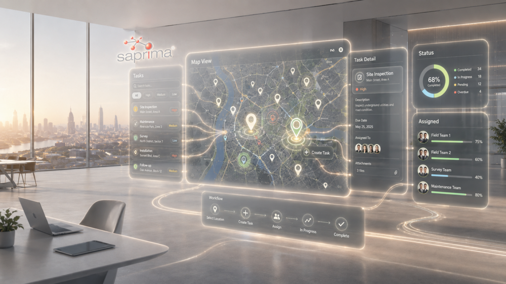
Many tasks do not originate at a desk, but directly on-site: on construction sites, technical facilities, inside buildings, on roads, in utility networks, or at customer locations. Exactly there, it is important to capture tasks quickly, assign them to a precise location, and track them reliably.
With saprima’s georeferenced task management, tasks can be created, processed, and monitored directly on a map. This makes it visible where work needs to be done, who is responsible, and what the current status of the task is.
Schedule a consultation appointment
Why Traditional Task Lists Are Often Not Enough
Many organizations work with spreadsheets, emails, or simple task lists. This works as long as tasks are clearly described and manageable. But once many tasks arise across different locations, things become more difficult.
Typical questions include:
Where exactly is the task located?
Which tasks are nearby?
Which locations have already been completed?
Where are delays occurring?
Which teams are responsible for which regions?
A simple list view can only answer these questions to a limited extent. Especially in field service, maintenance, construction, facility management, or municipal operations, the geographical context is crucial.
Create Tasks Directly on the Map
With saprima, tasks can be created directly within a map view. Users place a marker at the relevant location and assign the corresponding task.
A task can include information such as:
- task description
- responsible person or team
- priority
- status
- due date
- category
- photos and documents
- comments
- processing history
This creates a clear connection between location and task. Everyone immediately sees where action is required.
Better Overview Through Map Visualization
The map view helps users understand tasks spatially. This is especially valuable when many tasks are processed simultaneousl
The map quickly shows:
- which tasks are still open
- which tasks are currently in progress
- which tasks have been completed
- where tasks are accumulating
- which regions are particularly affected
- which assignments can be efficiently combined
This means saprima supports not only task administration, but also operational planning.
Transparent Tracking of Status and Progress
A georeferenced task is more than just a point on the map. It has a processing status and can be tracked throughout its entire lifecycle.
Typical statuses may include:
- New
- Planned
- In Progress
- Clarification Required
- Completed
- Reviewed
- Closed
This allows teams, coordinators, and managers to maintain a clear overview at all times. It becomes transparent which tasks are already completed and where further action is required.
Especially Suitable for Mobile and Decentralized Work
Die georeferenzierte Aufgabenverwaltung eignet sich besonders für Organisationen, die viele Aufgaben außerhalb eines zentralen Büros koordinieren müssen.
Typical examples include:
- maintenance operations
- construction and installation projects
- facility management
- municipal operations
- energy and utility companies
- telecommunications
- technical field services
- environmental and terrain surveys
- property and location management
- road and infrastructure inspections
Wherever tasks have a physical location, the map view provides significant added value.
From Individual Tasks to Managing Entire Operational Areas
One major advantage of saprima is that tasks do not need to be viewed in isolation. Multiple tasks can be analyzed by location, region, project, priority, or status.
This helps organizations better plan operational areas, for example:
Which tasks are close to each other?
Which route makes the most sense?
Which tasks need to be completed first?
Where do recurring problems occur?
Which locations generate particularly high effort?
This transforms many individual tasks into a manageable operational overview.
Integration with Project and Portfolio Management
saprima is not only a task management system, but also a platform for project and portfolio management. Therefore, georeferenced tasks can be linked with projects, initiatives, or programs.
Das ist besonders hilfreich, wenn operative Aufgaben Teil eines größeren Projekts sind.
Examples include:
a construction project with multiple tasks across different locations
a maintenance project covering many technical assets
a municipal program consisting of numerous individual measures across a city
a rollout project processing many locations step by step
With saprima, these tasks can not only be visualized spatially, but also integrated into the broader project context.
More Transparency for Management and Teams
The combination of map visualization, task status, and reporting creates a shared information base.
Teams see exactly what needs to be done.
Coordinators see how processing is progressing.
Management sees where progress is being made and where bottlenecks occur.
This simplifies coordination, reduces unnecessary follow-up questions, and supports better decision-making.
Typical Benefits of Georeferenced Task Management
Working with saprima offers several practical advantages:
- tasks are clearly assigned to locations
- processing status becomes transparent
- operational planning becomes easier
- routes and assignments can be combined more efficiently
- regional task clusters become visible
- responsibilities are clearer
- fewer tasks are lost or overlooked
- status reports can be generated more quickly
- operational work and management visibility are connected
Conclusion: Task Management Becomes Spatially Visible
Georeferenced task management with saprima makes tasks visible exactly where they arise: on the map.
Instead of managing tasks only in lists, organizations can plan, control, and analyze their work spatially. This creates better visibility, improved coordination, and transparent task execution.
For organizations with many location-based tasks, saprima becomes a powerful tool to connect operational work with project and portfolio management.
Do you want to manage tasks not only administratively, but spatially as well?
With saprima, you can capture, plan, and track tasks directly on the map — including status tracking, responsibilities, and reporting.